How to import custom elevation data
Posted on Categories Map Downloading
In QubiMap, you can import elevation data to view contour lines. Currently, QubiMap supports elevation data in various formats such as TIFF, ASC, ZIP, OVTMP, and SDB, which can be overlaid on the built-in SRTM or ASTER elevation data.
1. Import elevation data to QubiMap on PC
1) Set the elevation data type
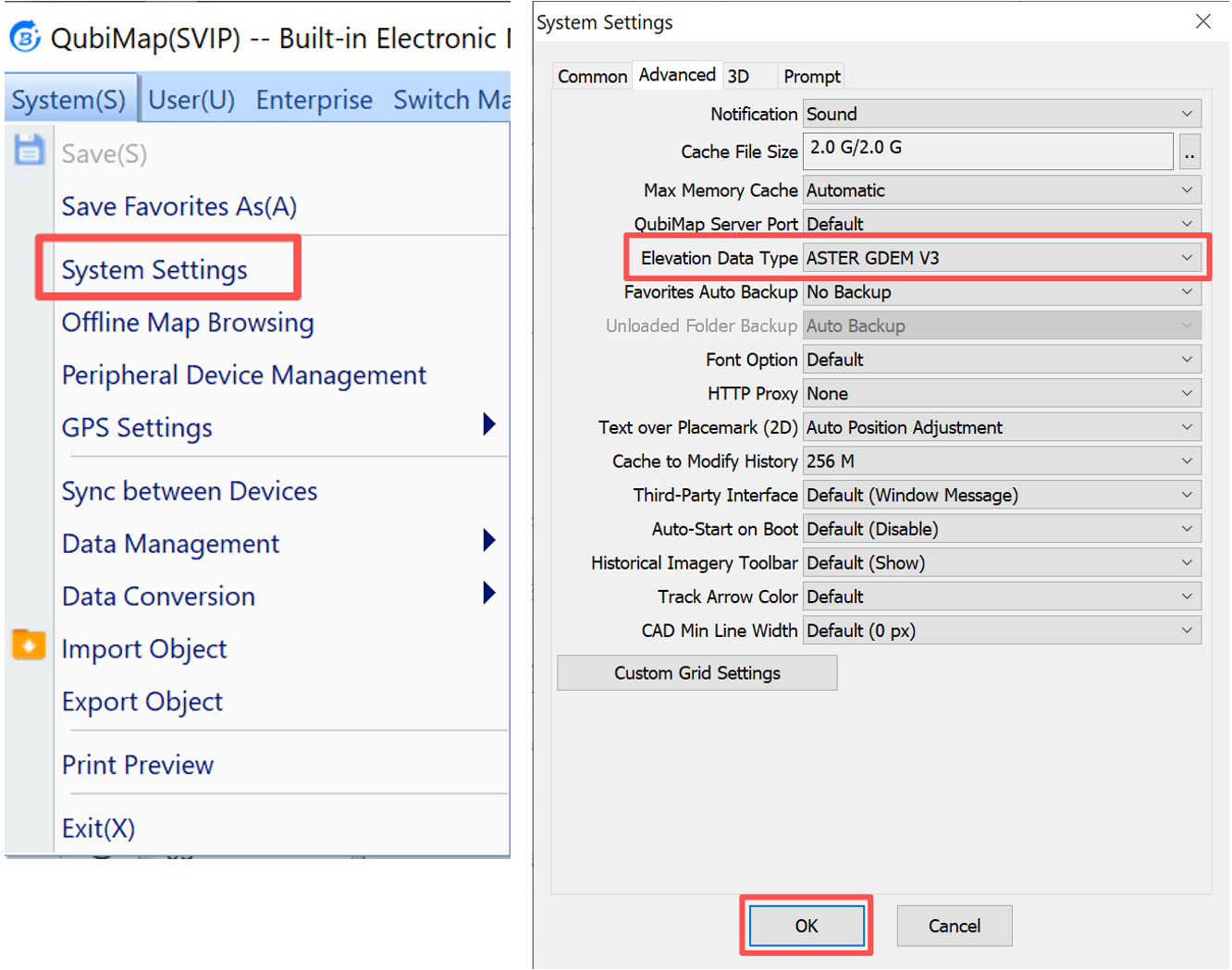
Choose [System] > [System Settings] > [Advanced] > [Elevation Data Type] to set the elevation data type. You can select [ASTER GDEM V3] or [STRM3]. In this example, [ASTER GDEM V3] is selected. Then, click [OK].
2) Import elevation data
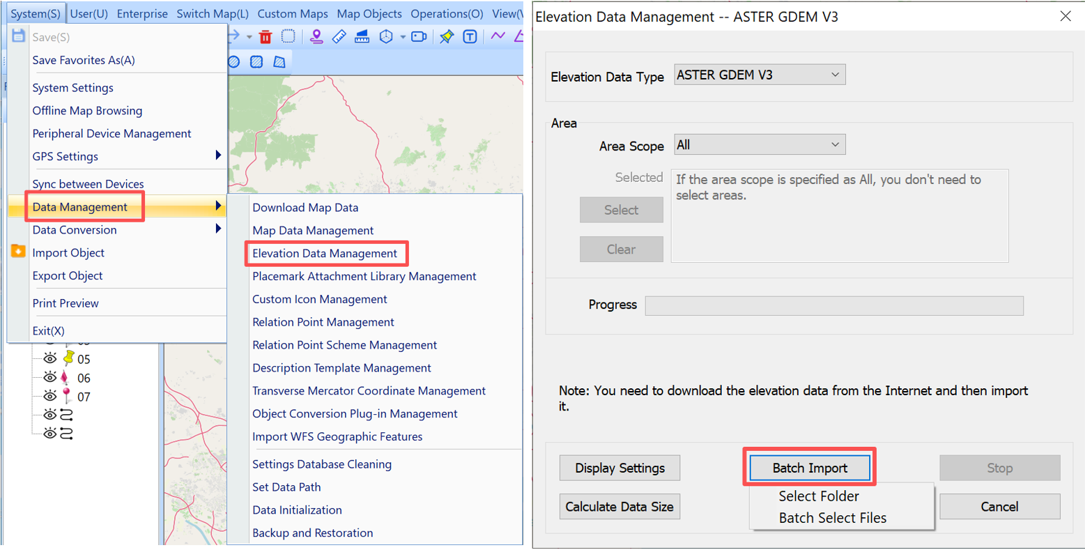
Choose [System] > [Data Management] > [Elevation Data Management]. In the dialog box that appears, click [Batch Import].
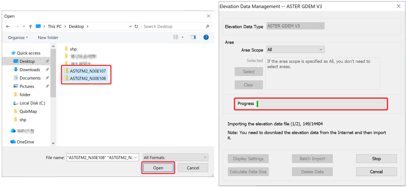
Select the elevation data file to be imported. You can select multiple files at a time. Then, click [Open]. The selected files are imported into QubiMap.
3) View contour lines
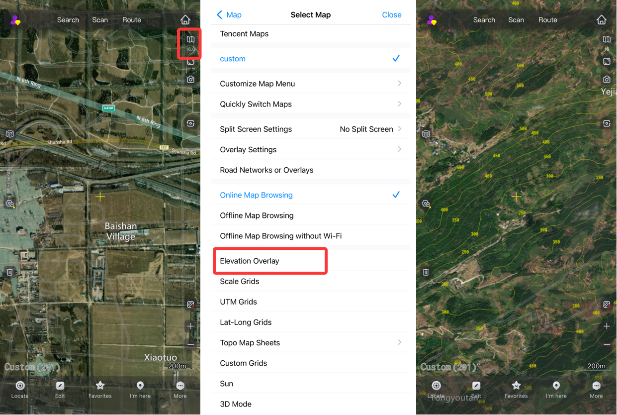
After importing the elevation data, you can view the contour lines in QubiMap.
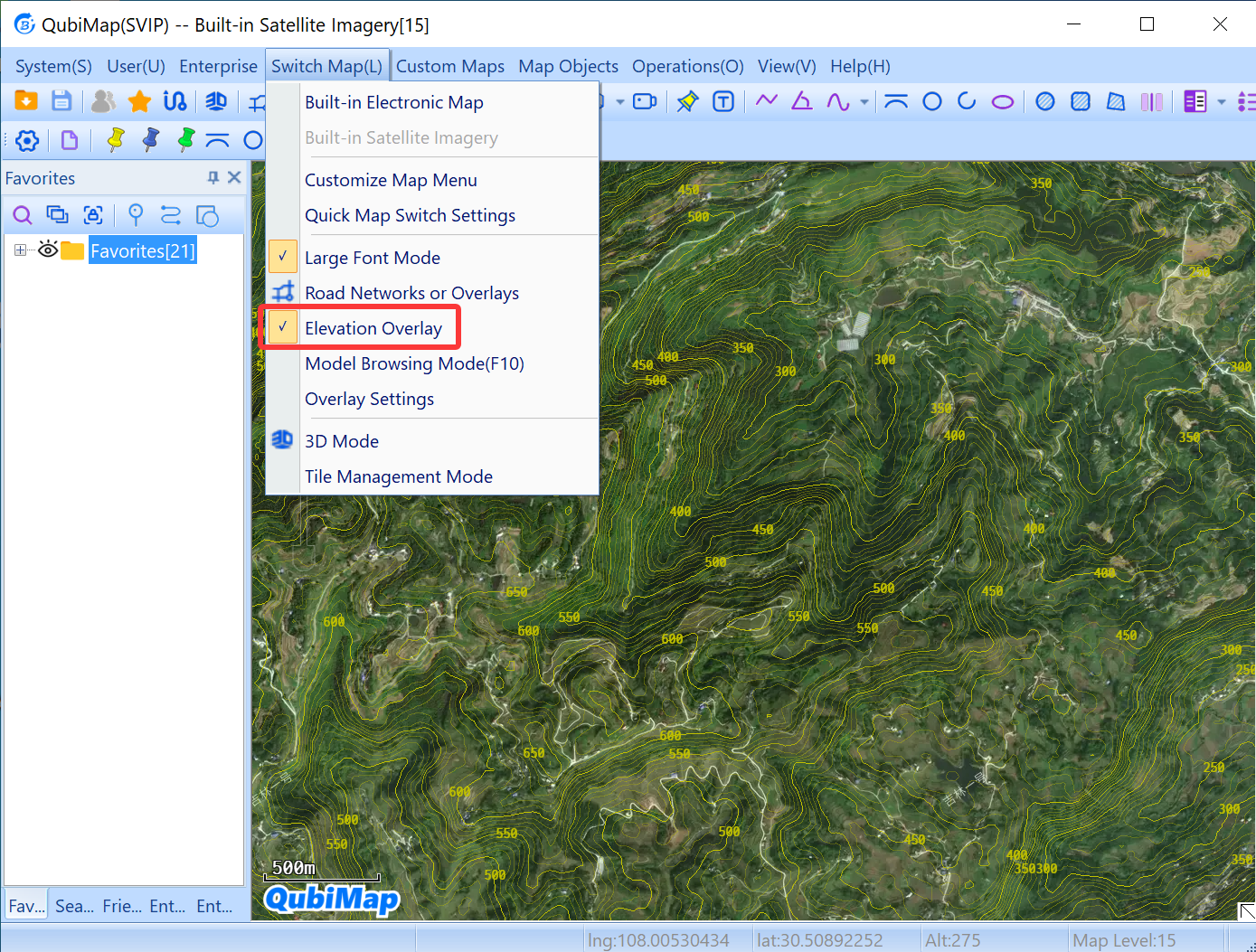
Choose [Switch Map] > [Elevation Overlay].
Set the map zoom level to 12 or higher to show the contour lines.
☆ Note: The imported elevation data is stored in the map folder under the QubiMap root directory.
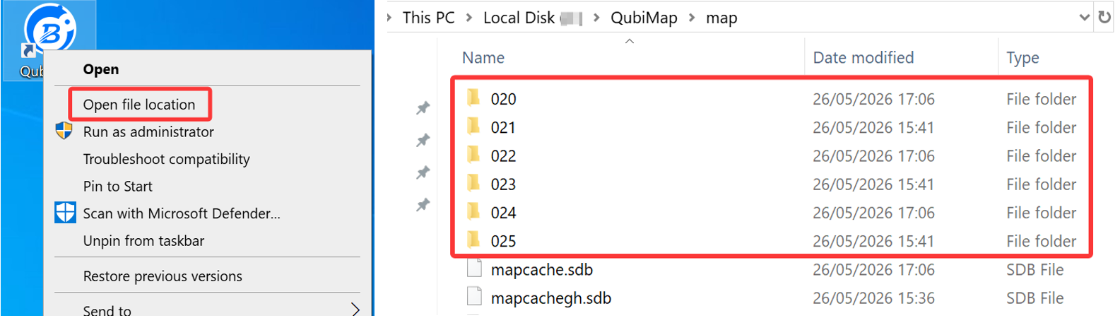
The following table shows the storage folders for different types of elevation data.
| Elevation data type | Projection type | Storage folder |
| SRTM3 | Mercator(china) | map\024 |
| Mercator | map\020 | |
| LatLng | map\022 | |
| ASTER GDEM V3 | Mercator(china) | map\025 |
| Mercator | map\021 | |
| LatLng | map\023 |
2. Import elevation data to QubiMap on a mobile device
1) Set the elevation data type
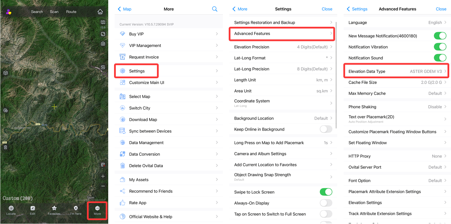
On the main UI of the QubiMap mobile app, choose [More] → [Settings] → [Advanced Features] → [Elevation Data Type].
You can select [ASTER GDEM V3] or [STRM3]. In this example, [ASTER GDEM V3] is selected.
2) Import elevation data
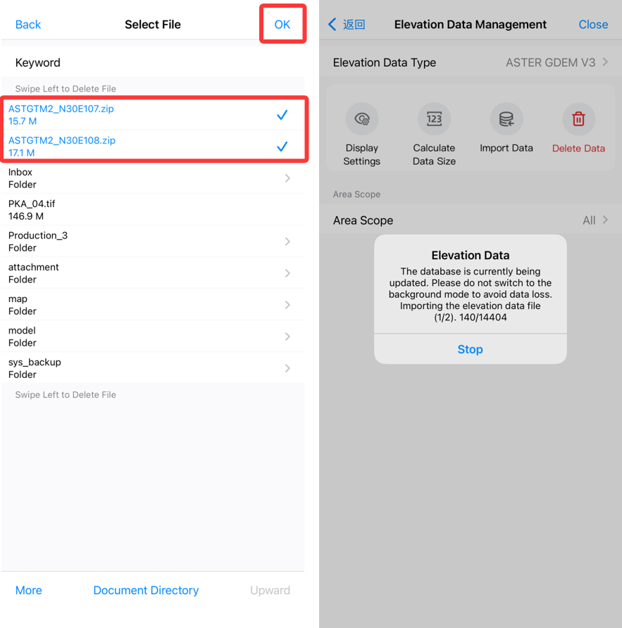
Choose [More] → [Data Management] → [Elevation Data Management] → [Import Data] → [Batch Select Files].
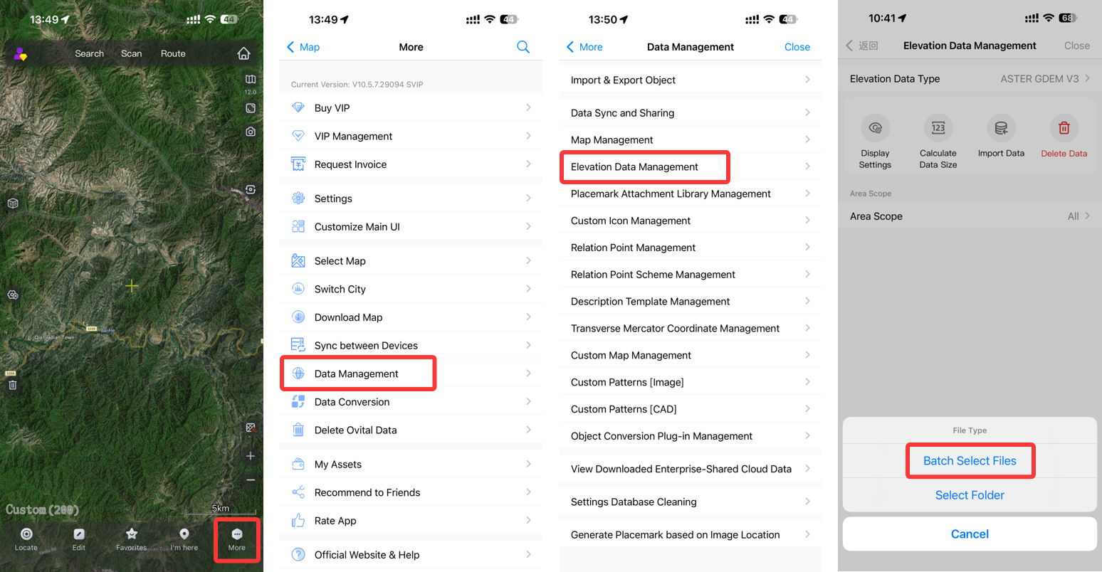
Select the elevation data file to be imported. You can select multiple files at a time. Then, tap [Open]. The selected files are imported into QubiMap.
3) View contour lines
After importing the elevation data, you can view the contour lines in QubiMap.
Go back to the main UI. Tap the  button, and select [Elevation Overlay].
Set the map zoom level to 12 or higher to show the contour lines.