How to export maps and QubiMap objects as images
Posted on Categories Map Downloading
Maps are essential whether for outdoor adventures such as hiking and mountain climbing or professional work like surveying. QubiMap allows you to export maps and other objects such as placemarks, tracks, and shapes as images (JPG, TIFF, PNG, BMP, etc.).
This article describes how to export maps and QubiMap objects as JPG or PNG images.
☆ Notes:
-
This feature is only available to VIP or SVIP users.
-
The size of pixels increases with the map area and map level.
-
The maximum size of an image that can be exported is 4.2 billion pixels (700 million pixels for a PNG or BMP image), covering an area of approximately 900 km² (rectangular area). The length of each side can be up to 65,536 pixels, about 30 km.
The procedure is as follows:
1. Download map data
To export maps and QubiMap objects as images from QubiMap, you first need to download map data for the required area. You can draw an area or select a system area.
For more details, see the help document “How to download map data (PC)“. We recommend that you draw a custom area to download the map.
2. Export as an image
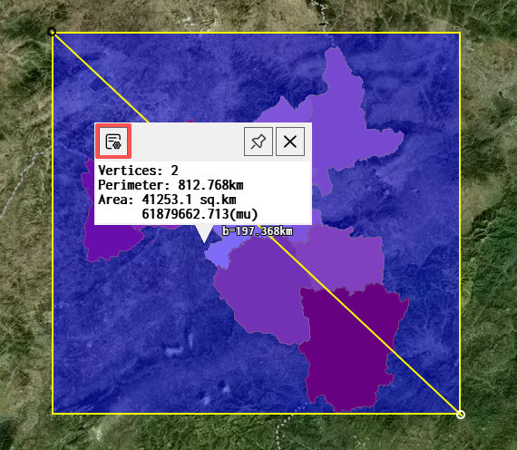
After you download the map, click on the area on the map and then click the  button.
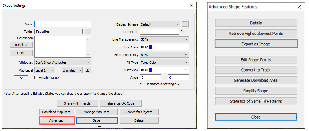
In the [Shape Settings] dialog box, click [Advanced] → [Export as Image].
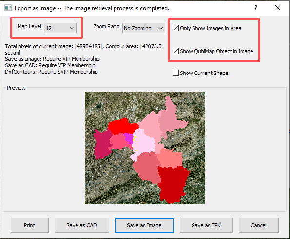
Set the map level, and select [Only Show Image in Area].
-
Map Level: Set this value based on the shape area and print size. Generally, map levels 12 to 16 are appropriate; if you set it to level 17 or 18, the image size may be too large.
-
Only Show Image in Area: We recommend that you select this option; otherwise, map data outside the specified area will be exported.
-
Show QubiMap Object in Image: Select this option if you need to export objects such as placemarks, tracks, or shapes within the area.
★ Note:
-
The [Save as Image] feature is only available to VIP or SVIP users.
-
If the exported map area expands or the map level raises, the image size increases.
-
The length of any side of a rectangular area cannot exceed 65536 pixels (about 30 km); otherwise, it cannot be exported. For a polygonal area, the outer rectangle is used for reference.
-
If the image cannot be previewed, we recommend that you lower the map level or reduce the size of the exported area.
The following table shows the limits corresponding to VIP levels and image formats:
| VIP level | Image format | Pixel limit | QubiMap object limit | |
| VIP | JPG, TIF, PNG, BMP | 100,000,000 | 20,000 | |
| SVIP | PNG, BMP | 700,000,000 | 1,000,000 | |
| JPG, TIF | 4,200,000,000 | 1,000,000 | ||
After you set the parameters, click [Save as Image] → [Save as Image] or [Add Legend and Save as Image].
-
If you are sure you have downloaded all map data but still receive a message indicating that some images have not been downloaded, click [No].
-
If the exported image has more than 700 million pixels, the following message appears: Images of more than 700 million pixels can only be exported in JPG and TIF formats. Click [OK].
-
If the image has no more than 700 million pixels, the [Save As] dialog box appears.
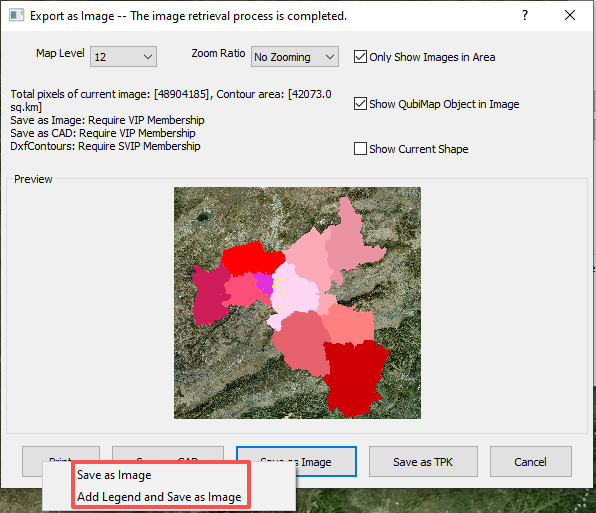
In this example, click [Save as Image] → [Add Legend and Save as Image].
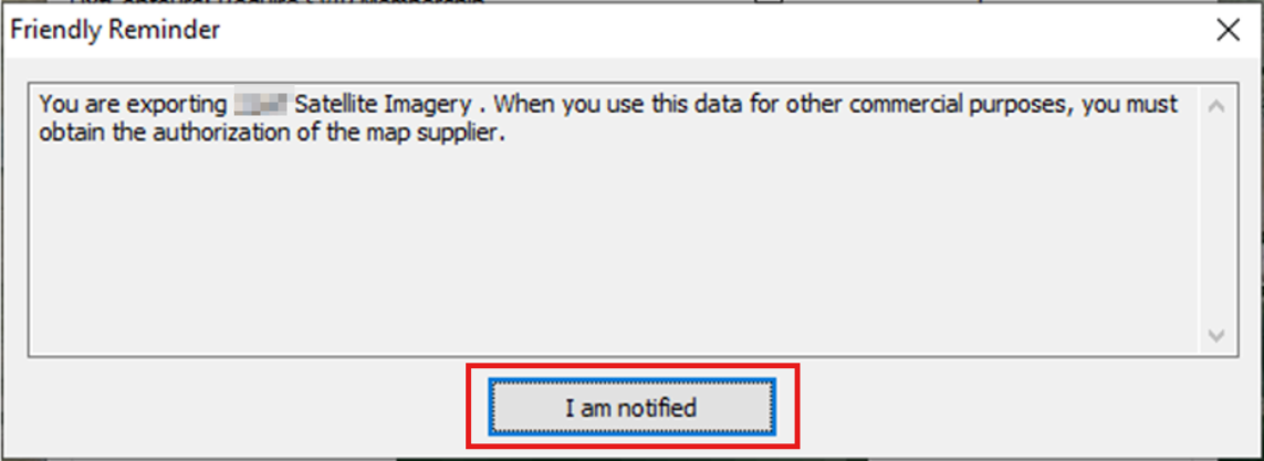
The following friendly reminder appears. Click [I am notified].
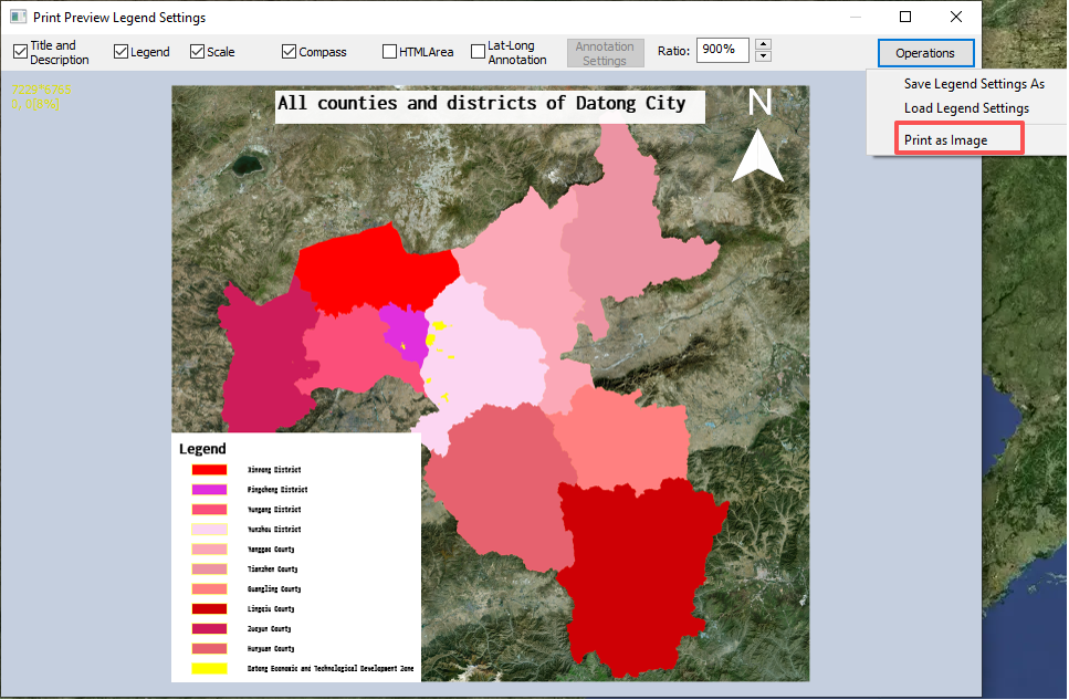
In the [Print Preview Legend Settings] dialog box, set the parameters as needed. Then, click [Operations] → [Print as Image].
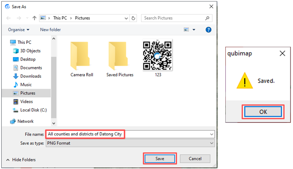
Enter a file name, set the file format as JPG, PNG, or BMP, and then click [Save].
In the message that appears, click [OK].
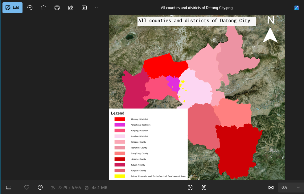
The exported image is shown as follows. In this example, the map level is set to 12. The display is optimal when you set the zoom ratio to 100%.
After exporting the image, you can print it.