How to retrieve the altitudes of placemarks
Posted on Categories Common Features
In QubiMap, you can view the altitude of a single placemark, or retrieve the altitudes of multiple placemarks at the same time. The retrieved altitude information can be exported to a TXT or Excel file.
Before you retrieve placemark altitudes, make sure that the elevation data has been imported to QubiMap. For more information, see the help document “How to import elevation data”.
The procedure is described as follows:
1.Retrieve the altitudes of multiple placemarks
On the main UI, choose [System] > [Data Conversion] > [Retrieve Placemark Altitude].
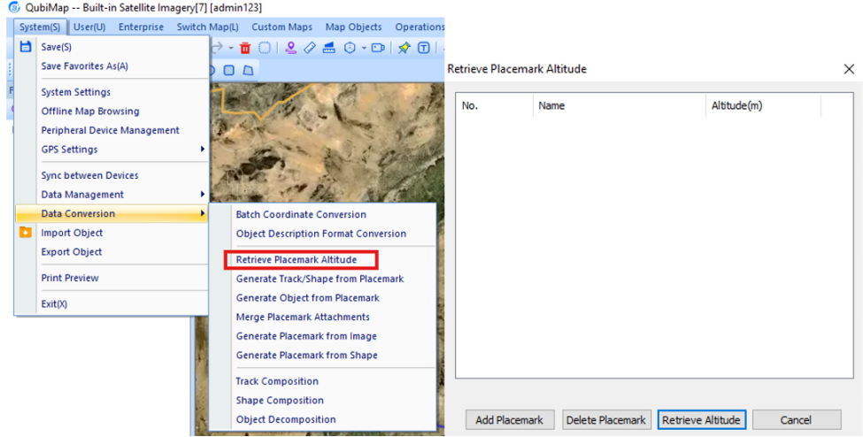
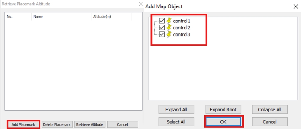
In the [Retrieve Placemark Altitude] dialog box, click [Add Placemark]. Select the required placemarks, and click [OK].
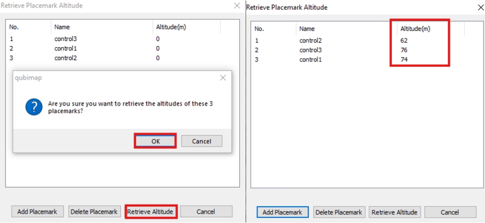
Click [Retrieve Altitude]. In the message that appears, click [OK].
2.View the altitude of a single placemark
1)PC
Find the required placemark on the map, click it, and then click the settings icon.
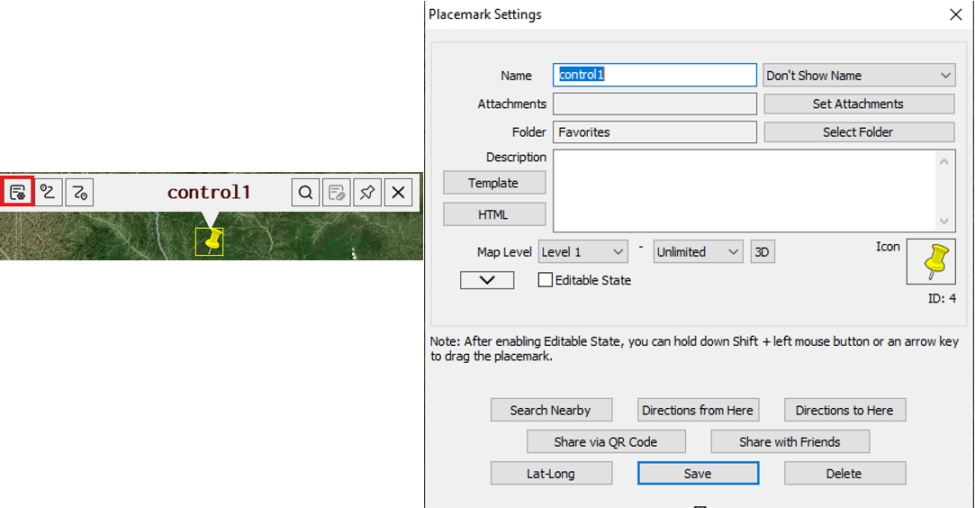
In the [Placemark Settings] dialog box, click [Lat-Long] to view the latitude and longitude of the placemark. In the [Lat-Long] dialog box, click [Retrieve Altitude] to view the altitude of the placemark.
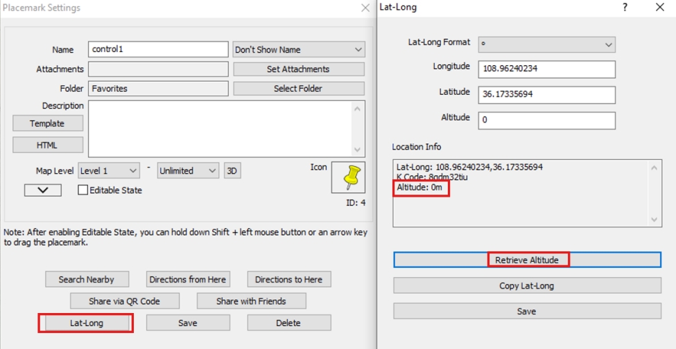
2)Mobile device
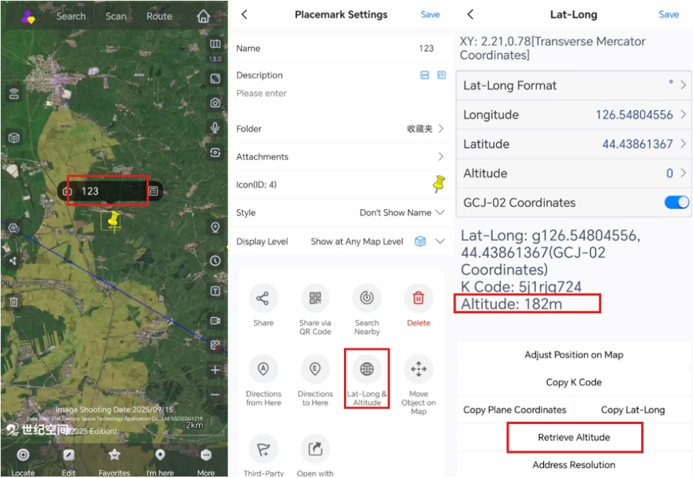
Find the required placemark on the map, tap the placemark, and then tap the displayed placemark name. On the [Placemark Settings] page, tap [Lat-Long & Altitude]. On the [Lat-Long] page, tap [Retrieve Altitude] to view the altitude of the placemark.