How to view the track profile and calculate the cut or fill volume and area on a PC
Posted on Categories Object Editing
In QubiMap, you can view the profile (section) of a track and calculate the fill or cut volume and area of a shape. These features are only available to SVIP users.
This article describes how to use these features on a PC. For information about how to use these features on a mobile device, see the help document “How to view the track profile and calculate the cut or fill volume and area on a mobile device“.
1. View the track profile (section)
On the main UI, click the 3D button to enter 3D mode.

Click the  button and select [Section]. You can create a track or select an existing track to view its profile.
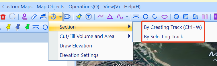
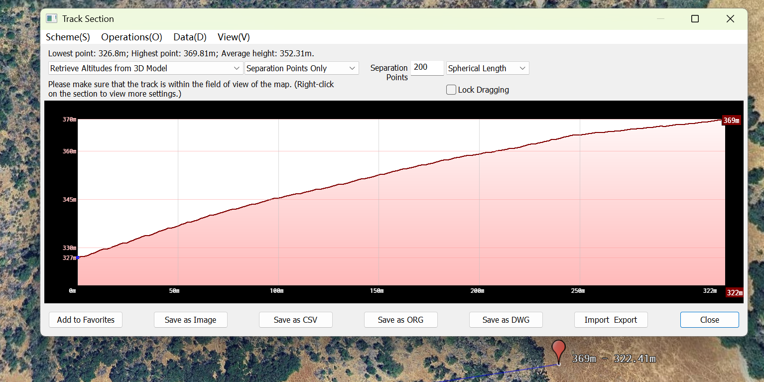
By Creating Track: Draw a track on the map. Click to draw, and double-click to finish drawing. Then, the sectional view is demonstrated.
By Selecting Track: Select a track from your favorites. Click the  button and choose [Section] > [By Selecting Track] to select a track, and then click [OK].

The sectional view is demonstrated.
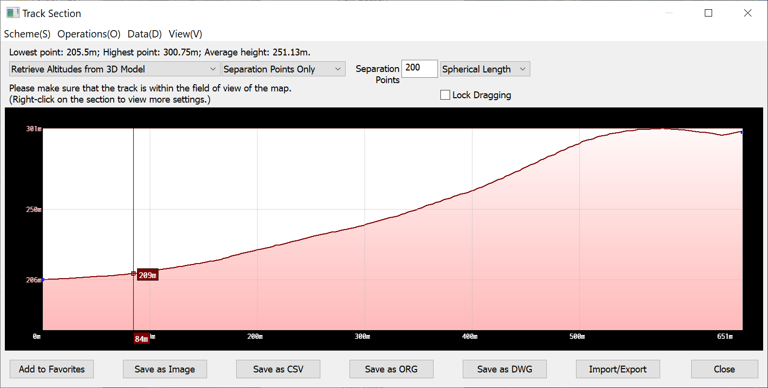
In the [Track Section] dialog box, you can view the elevations of the lowest and highest points and the average height of the track. You can select one of the following methods to retrieve the elevation data: [Retrieve Altitudes from Track Points], [Retrieve Altitudes from Elevation Database], [Retrieve Altitudes from 3D Model], and [Combine Heights of Track Points & Terrain]. You can also set the number of separation points and specify whether to include track points. The generated track profile can be saved as an image, CSV, ORG, or DWG file.
2. Calculate the fill or cut volume and area
This feature is commonly used for the earthwork in building, road, and bridge construction.
On the main UI, click the 3D button to enter 3D mode. Then, click the  button and select [Cut/Fill Volume and Area]. You can create a shape or select an existing shape for calculation.
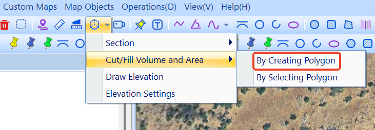
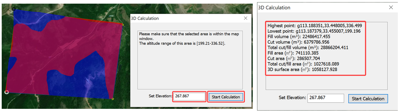
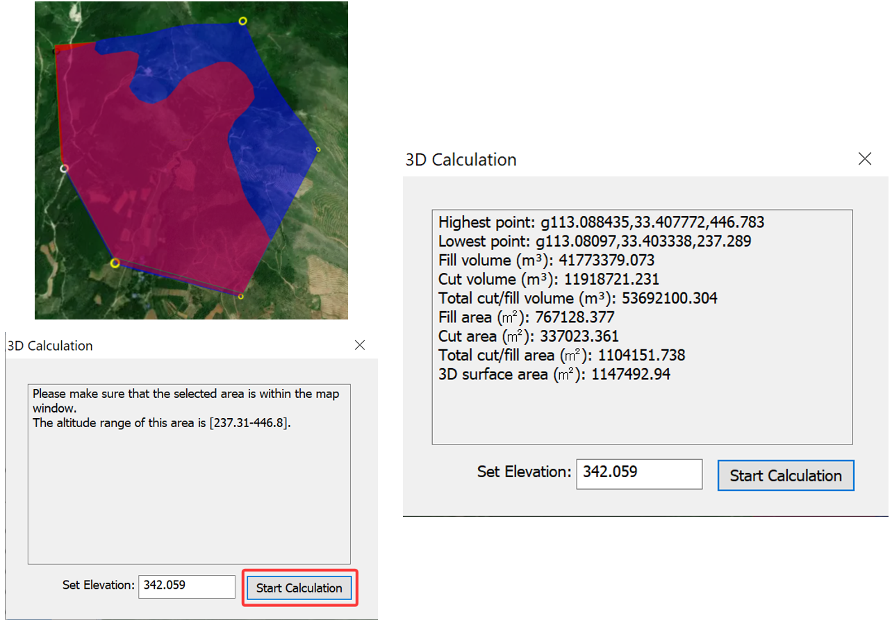
By Creating Polygon: Draw a polygon on the map. Click to draw, and double-click to finish drawing. The [3D Calculation] dialog box appears. You can set the elevation and click [Start Calculation]. The cut/fill volume and area within this region is automatically calculated.
By Selecting Polygon: Select a shape from your favorites. Click the button and choose [Cut/Fill Volume and Area] > [By Selecting Polygon] to select a shape, and then click [OK].
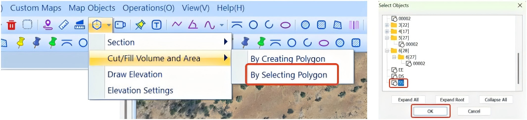
Then, you can set the elevation and click [Start Calculation].